
WeRobotics Partners with Elevate Africa UAS Summit 2024
April 30, 2024
WeRobotics is proud to be partnering with the Elevate Africa Summit to be held in Nairobi, Kenya in June 2024.
August 23rd, 2018

The past three years’ worth of work at WeRobotics on the use of drones for humanitarian aid has revealed a few persistent gaps. One is the ability to coordinate teams of drone pilots effectively in remote areas, without internet yet still within a consistent and integrated data structure. Another is the ability to rapidly analyse large amounts of aerial data and compile it into useful information which can be distributed to decision makers in ways that demonstrably improve their actionable information.
Each of these issue rose to the fore last June when WeRobotics teamed up with the World Food Programme (WFP) to run a needs assessment and disaster simulation for public, private and non-profit stakeholders. Since then not much has changed in Peru to improve the situation for humanitarian drones and data coordination.
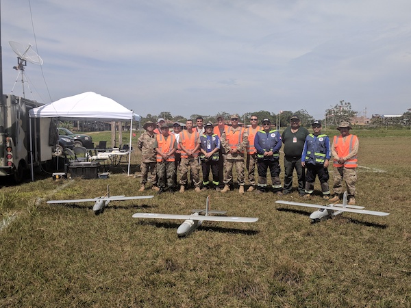
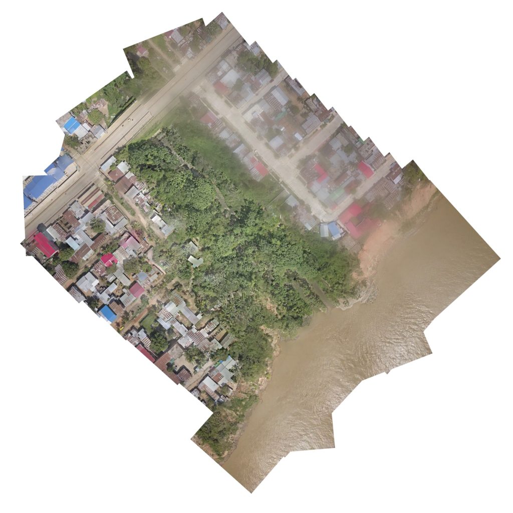
But this month we headed to the Madre de Dios region of the Peruvian Amazon to try to fill some of those gaps. Fortunately, we had plenty of help.
 Joining us in Madre de Dios for a large scale disaster simulation exercise were our colleagues in Peru Flying Labs, the Peruvian Air Force and disaster management agency (INDECI), a number of other local Peruvian civil society humanitarian actors, as well as our colleagues in Amazon Web Services (AWS) disaster response and the Harvard Humanitarian Initiative (HHI), with software support from Esri and Drone Deploy. Collectively we worked to integrate not only drone coordination but web GIS, spatial analytics and interactive reporting into the regular practice of collaborative disaster response.
The heart of this effort on the technology side was expected to be the first operational deployment of the newly released version of Amazon’s Snowball Edge mass storage and ruggedised field server device. The latest version of the Snowball Edge advances Amazon’s efforts beyond data transfer to extend full-scale AWS functionality to areas with limited or no internet connectivity.
On top of a 100TB S3 storage stack sat a full EC2 compute layer to possibly run most versions of processing and analysis software that would otherwise require access to Amazon’s (or others’) cloud computing environment to work collaboratively at reasonable scale, scope and speed.
While much had been learned from initial open source pilot tests of the Snowball Edge engaged earlier this summer by colleagues in Humanitarian Open Street Map (HOTOSM), we decided for this simulation exercise to install the full suite of ArcGIS Enterprise, ArcGIS Pro and Esri’s photogrammetric processing software Drone2Map to see whether we would be able to put integrated enterprise level tools to work building and testing data coordination workflows and analytic techniques. Our ultimate goal will be to see whether we can use a full web GIS environment for aerial data even without access to the web.
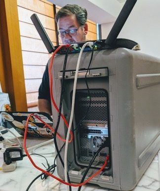

One of the potentially significant advantages of the Snowball Edge will then be the ability to link everything we do in the field back to AWS for sharing and further analysis once we’re done in the field.
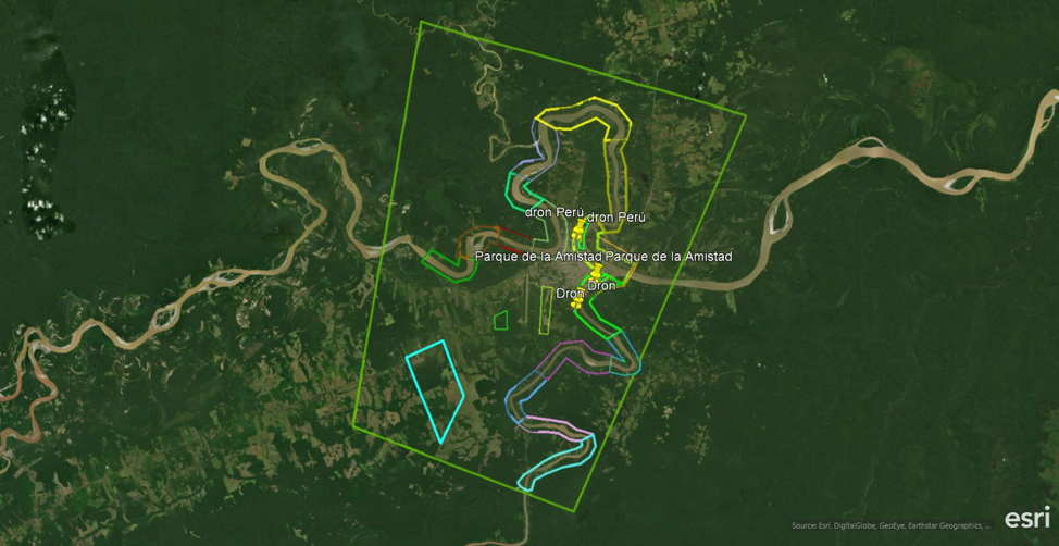
In addition to the Snowball Edge and the Esri ArcGIS stack we put Drone Deploy’s Live Map tool to work for real-time processing of orthomosaic maps. In combination, these tools hold out reasonable promise that we may be able to bridge long-standing gaps in humanitarian drone coordination, data analytics and operational communications.
And as always WeRobotics roots that promise in collective action between national and local leaders in humanitarian action so that the benefits of emergent technologies for social good flow to affected communities and the most vulnerable.
Keep an eye out over the coming months for updates on this exciting work and reflections on the future of humanitarian drones!
