
Breaking the Language Barrier: WeRobotics Partners with Beluga Linguistics...
April 23, 2024
With language localization, the Flying Labs Network will now step into a more interconnected and inclusive future.
July 5th, 2018

Authored by Amrita Lal, Coordinator of Pacific Flying Labs
The Integrated Vulnerability Assessment (IVA) Project is a community focused project that aims to combine local indigenous knowledge and experiences with scientific methods for data collection and analysis, and use of available technology to create a database that quantifies the level of vulnerability towards Climate Change for the Fiji islands. The project was initiated after consultations with Government officials in Fiji and is currently completed with the help of Pacific Center for Sustainable Development (PACE-SD), Pacific Flying Labs, local ministries with interest shown by the churches in Tonga. The project has been designed in line with the Sustainable Development Goals (SDGs) Framework, Sendai Framework for Disaster Risk Reduction and the United Nations Framework Convention on Climate Change.
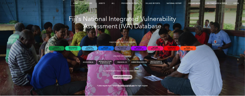
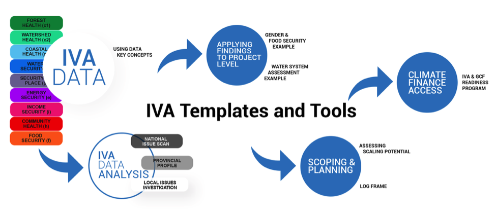
The IVA project focuses on nine livelihood assets (pictured below) and assesses them against human objectives such as ecosystems, infrastructure, finance, human resources and institutions. It takes a holistic approach towards village profiling by finding gaps in knowledge through interviews and field researches to answer simple climate change related questions.
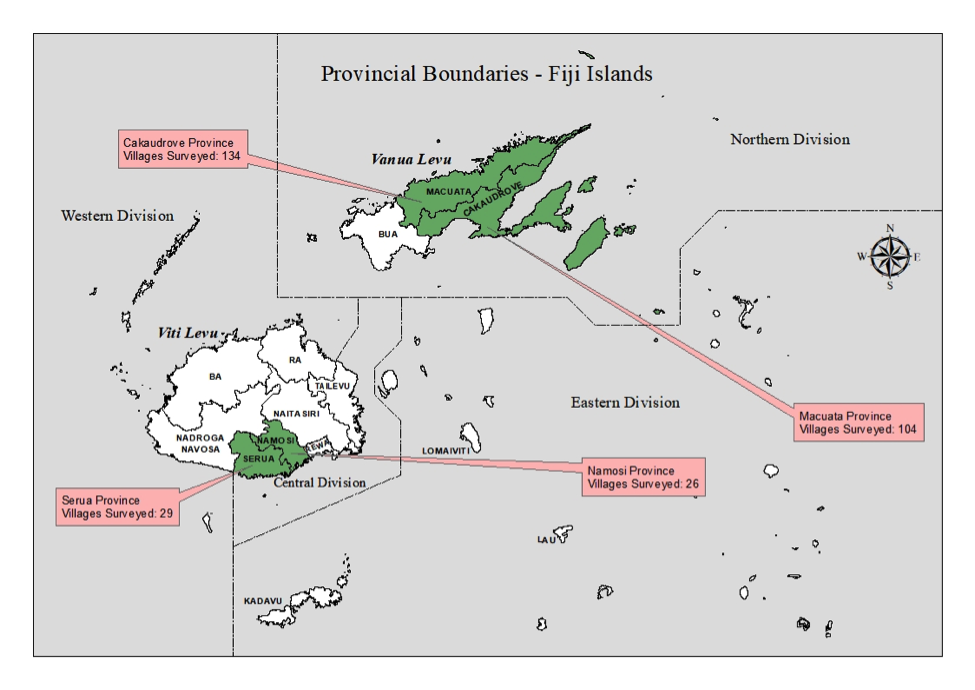
So far four provinces, two in Viti Levu (main island) and two in Vanua Levu have been surveyed which includes around 293 villages.
The project's integration with Pacific Flying Labs is to ensure that the physical geography aspect of village vulnerability assessments is covered and data that has already been collected is verified. Some of our main activities will be to firstly map out the villages and its resources using our fleet of drones. Many of these villages are located along the coast, so we will be mapping the coastline, the village itself, nearby vegetation, farm land and so forth. Mapping out the village will be done to keep track of changes in the coming years by setting up imagery baselines to refer to or utilize in events of natural disasters in the future. For years, OpenStreetMap and Google Earth have been helpful but the level of accuracy and integrity of the data has always been questioned.
The second focus will be on the presence of invasive plant species and native vegetation health. Previously, such data had been collected through means of interviews, transects, photographs, recordings and extensive fieldwork but now we will use available sensors such as the Parrot Sequoia sensor mounted on DJI Phantom drones, photogrammetric software along with ArcMap to assess the level of threat climate change has or might have on villagers livelihood and food security.
T third focus of the project will be to draw the attention of the right government bodies and organizations in order to overcome the hazards and challenges identified. The project started 2 years ago and is still in its early stage. Once completed, it will provide vital information for various organizations, information which has been through the process of ground trothing and validated by a team of government officials.
