
Breaking the Language Barrier: WeRobotics Partners with Beluga Linguistics...
April 23, 2024
With language localization, the Flying Labs Network will now step into a more interconnected and inclusive future.
March 28th, 2018

We were in Fiji earlier this month to work on a number of projects with our Pacific Flying Labs. One of these entailed the use of underwater drones to study the health of coral reefs near Maui Bay. We had the opportunity to test two new underwater drones for this project: the Trident by our technology partner, OpenROV and the PowerRay by the company PowerVision. Both drones only became available a just few months ago. In fact, we were the first not-for-profit organization to gain access to the Trident thanks to OpenROV's invaluable support. These two underwater drones are now part of the Pacific Flying Labs fleet along with 2 aerial drones that we transferred to the team in Fiji. We're planning to provide our other labs such as Tanzania Flying Labs with underwater drones as well in coming months. So what follows are some initial observations and lessons learned in the use of these underwater drones for data collection.
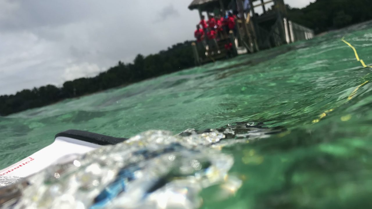
The first point to note is that underwater drones are tethered unlike most aerial drones (the yellow cable in the above photo). As such, their range is limited by the length of the tether. On the plus side, the drones we tested in Fiji have 2-3 hours of battery life. Another difference between underwater and aerial drones is that the former can only piloted manually while the latter can be programmed to operate autonomously. The reason is simple: GPS is not available underwater. The underwater drones we tested in the Pacific do have various features that seek to make the manual piloting easier. The PowerRay, for example, offers altitude (or rather depth) control to keep the drone more or less at the same depth while the Trident offers a stabilization feature.
Another difference between underwater and aerial drones is that the later are almost always piloted Beyond Visual Line of Site (BVLOS) contrary to most aerial drones. In other words, one loses sight of underwater drones within just a few meters of depth whereas aerial drones can be seen from several hundred meters away. This makes knowing where the drone is relative to your position rather challenging. An underwater drone pilot will have live video footage of what the drone sees right in front of them, but that can be quite limiting when operating BVLOS. On the plus side, the Trident software does include a helpful compass feature, displaying the direction that the drone is pointing in, which is a plus. But still, manually operating a drone BVLOS whether it flies or swim is particularly tricky.
In addition, piloting the underwater drones to swim in straight lines (to do transects, for example) or to swim around a point of interest from different angles (to create 3D models or 360 panoramic photos) is equally challenging and takes some serious practice. And even with said practice, we found ourselves having to try and manually correct for invisible currents at various depths. Aerial drones can automatically correct for winds, thanks to GPS.
In many ways, the experience I had in piloting these underwater drones reminded me a lot of what it was like to fly the Phantom 1 when it came out in 2013. It was a very manual experience with a fixed camera. The same is true of the underwater drones. In other words, if you want the camera to capture a particular scene, you had to point the Phantom 1 towards the scene in question and adjust the altitude accordingly, often from hundreds of meters away, which meant quite a bit of guesswork (and luck) until you clocked many hours of practice. The underwater drones have fixed high definition cameras, meaning no gimbals to provide the very smooth footage that the Phantom 4 provides today. What's more, the cameras of the underwater drones are forward facing. This means you'd need to attach a GoPro or similar camera to the bottom of the underwater drone if you wanted to capture vertical imagery to produce bathymetry maps.
I have no doubt that like the Phantom's 3 iterations since the first model came out half-a-decade ago, the future iterations of the Trident and PowerRay will make equally important strides. In the meantime, below are some initial recommendations based on our lessons learned. If we're missing any, then please let us know!
Based on this experience, here's what we'd like to see in future iterations of underwater drones:
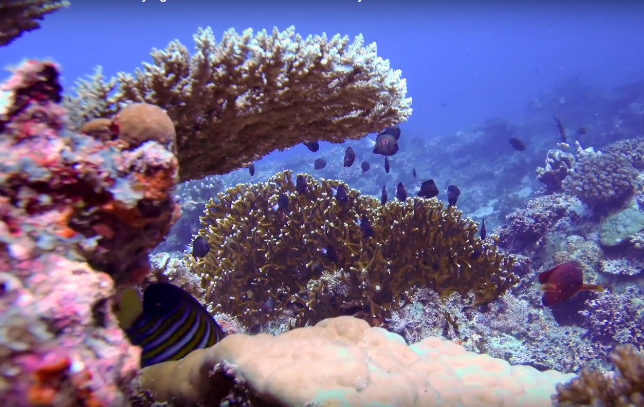
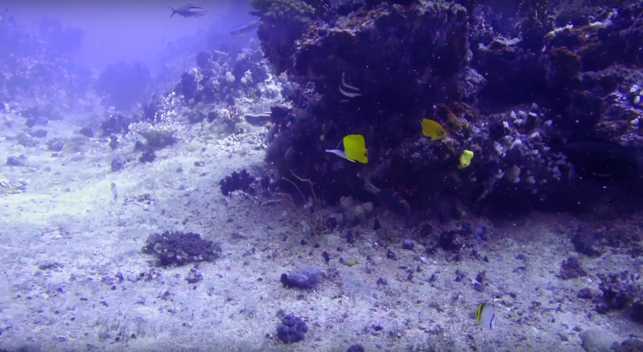
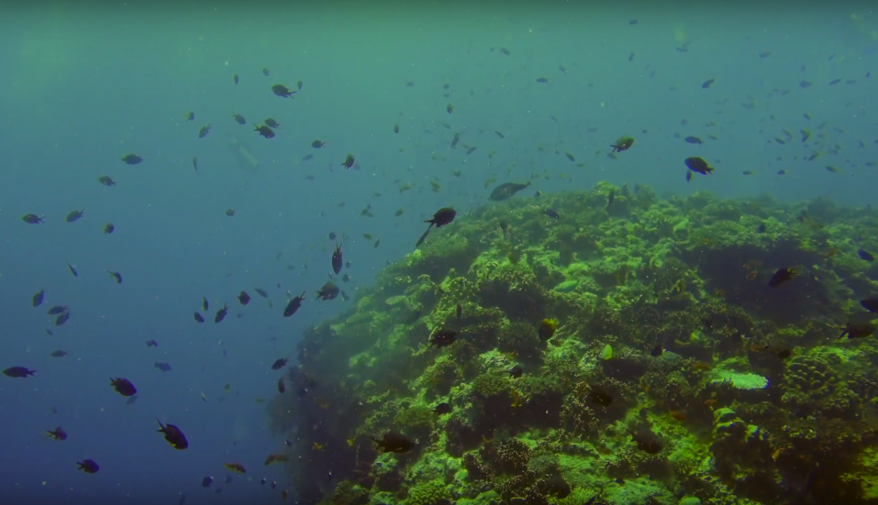
Many thanks to DFAT, Atlassian Foundation, Solve MIT, the University of the South Pacific and OpenROV for their invaluable support and partnership on Pacific Flying Labs. Our labs in Fiji trained young women between the ages of 12-18 years old on how to use these underwater drones to explore the marine life around them and study the health of corals. Pacific Flying Labs will continue to use these underwater drones for a range of projects in the months to come. Below is a short compilation of some of the underwater footage that our Pacific Flying Labs captured with the drones in question. Enjoy!
