Reframing Power: Perspectives from the Flying Labs Network
April 8, 2024
Flying Labs share their perspectives on power in a profound demonstration of what we mean when we say the “Power of Local”.
March 12th, 2018

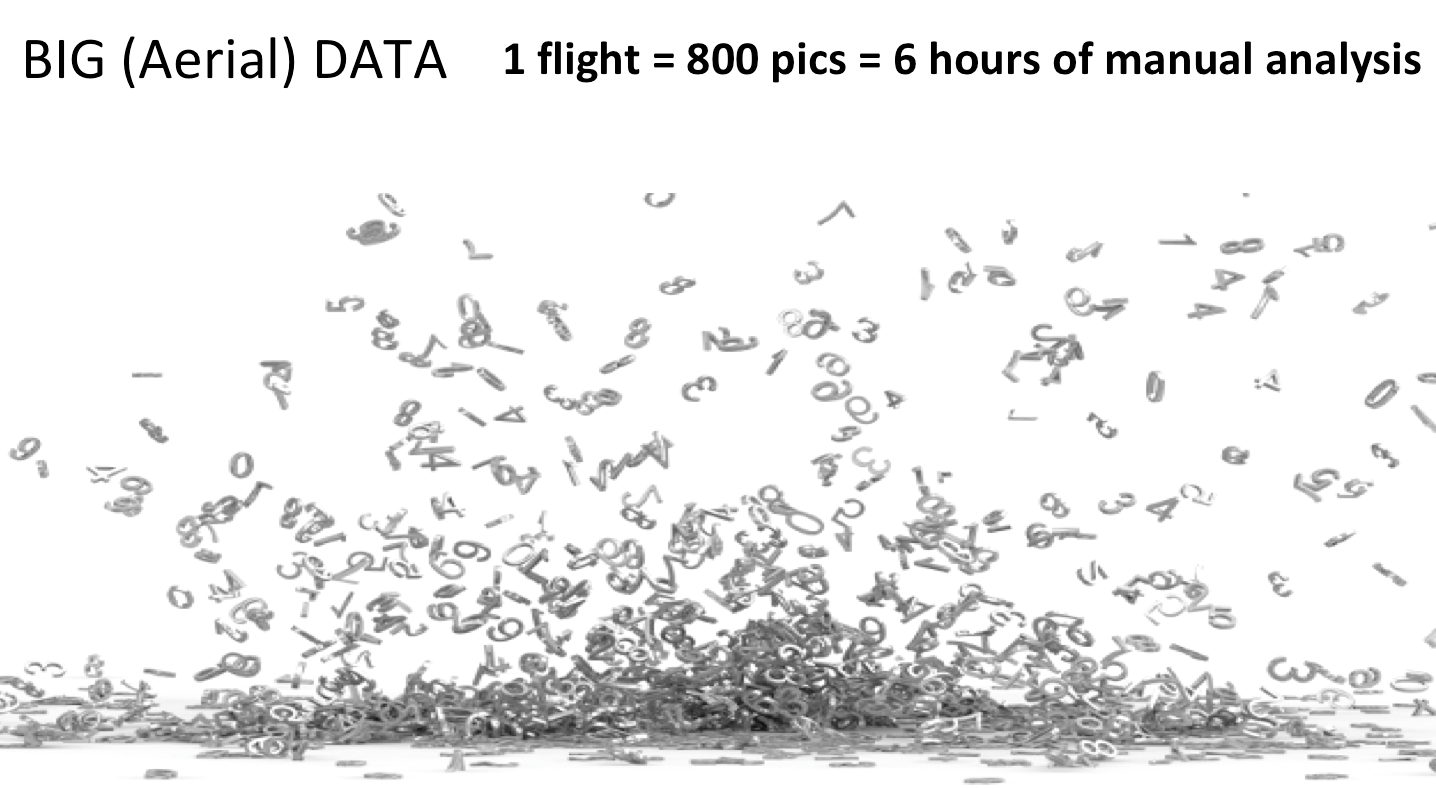
We launched our Open AI Challenge in early January and have already received a number of initial results. The purpose of our Open AI Challenge series is to crowdsource the development of automated solutions for the analysis of aerial imagery; with specific focus on humanitarian, development and environmental projects. Aerial imagery has rapidly become a Big Data challenge, which is why we're turning to the use of Artificial Intelligence (AI), machine learning, computer vision and predictive analytics. The aim is to better inform our partners while enabling them to better leverage data and technology to enhance and innovate on public services and infrastructure.
Our first Open AI Challenge is a joint effort with the World Bank and OpenAerialMap. The initiative focuses on the analysis of aerial imagery for food security assessments and transportation infrastructure in the South Pacific. More specifically, the challenge uses aerial imagery from Tonga, which was recently hit by a high-end Category 4 Cyclone in February. The World Bank and the Government of Tonga are keen to leverage drone technology and AI to improve public services and infrastructure. So we're now busy evaluating the initial results of the challenge submitted by several universities and researchers. We've also been in touch with additional universities that are now also engaged with us on this Open AI Challenge series. So big, BIG thanks to everyone who is participating! We'll be sure to provide regular updates as we receive new results.
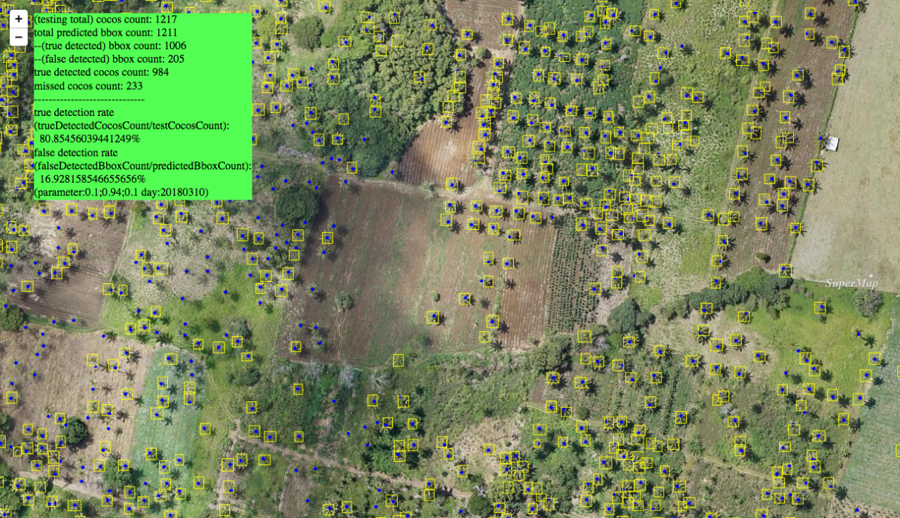
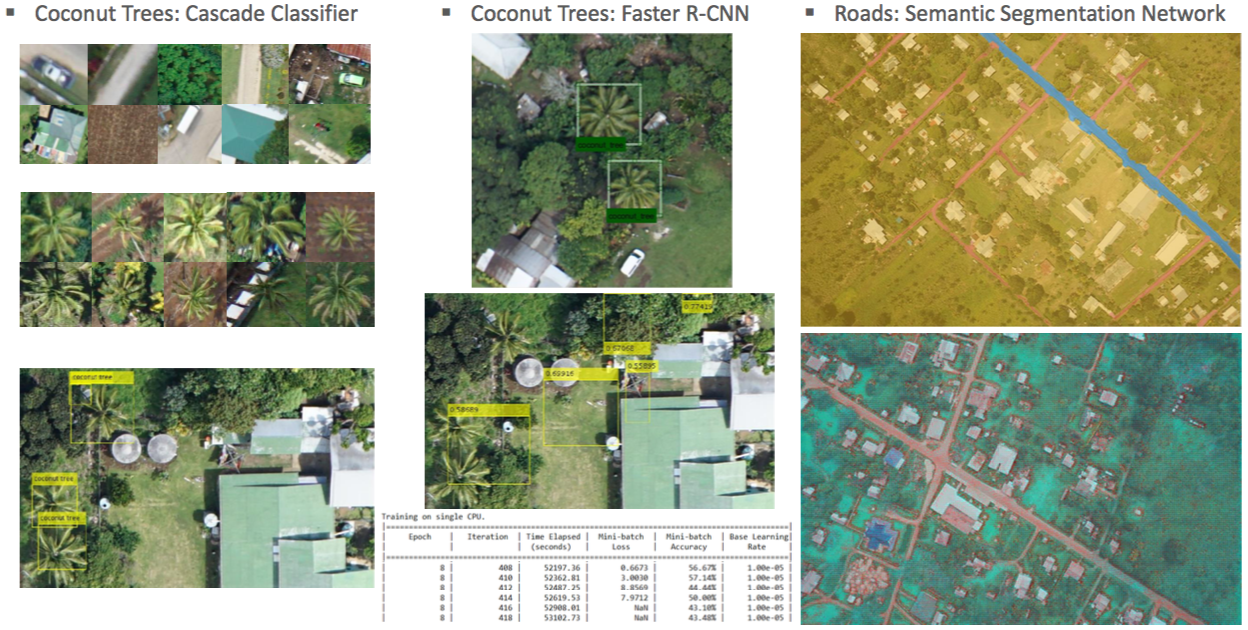
In the meantime, the visuals below represent some of the initial results that we have received. These focus on the automatic classification of crops—particularly coconut trees.