
Reframing Power: Perspectives from the Flying Labs Network
April 8, 2024
Flying Labs share their perspectives on power in a profound demonstration of what we mean when we say the “Power of Local”.
November 21st, 2017

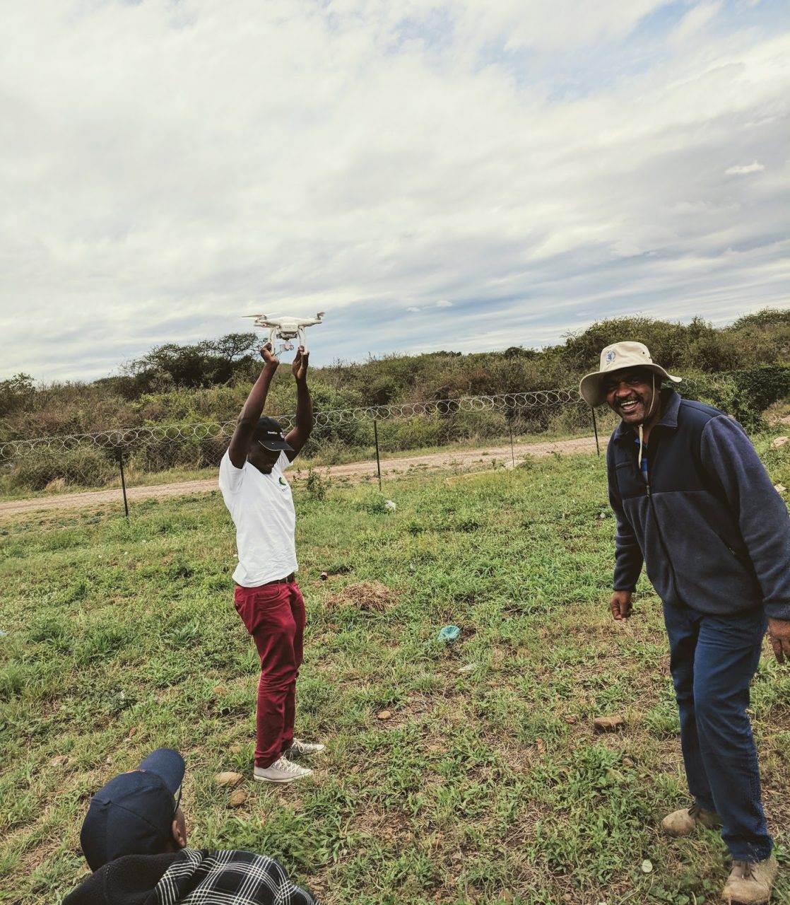 UAVs take to the skies outside Maputo, Mozambique as part of a three-day humanitarian workshop-simulation sponsored by WFP and supported by WeRobotics.
The November morning sky over Maputo is a dense grey, stuffed with clouds. The night before, heavy winds and rains howled through narrow streets, brimming with near-instant flood waters. Each year, flooding in Mozambique is a serious natural hazard. The Limpopo River routinely bursts its banks, drenching local communities. If a response operation had to map this particular area today using satellite imagery most would be blocked from above by the dense clouds. This is a case in point for the utility of UAVs which fly low to capture high resolution image data.
Although we didn’t plan it this way, it’s a reasonably accurate setting for the last in this year’s series of collaborative humanitarian UAV coordination workshop-simulations. The series was organized along with partners in the World Food Programme (WFP), Emergency Telecommunications Cluster (ETC), national disaster management agencies and other key NGO and private sector stakeholders. Mozambique is the fourth host for these events, previously also held in May in the Dominican Republic, June in Peru and July in Myanmar.
Key Gaps: Systems, Regulations, Partnerships and Data
Before participants get to fly the robots there’s much work to be done. First we have to guide them through two days of intensive seminar-style sessions analyzing the country’s disaster management systems, regulatory structures and partnership opportunities and data needs in order to understand the possibilities and the limits of UAV technologies for disaster preparedness and response in Mozambique. As we’ve discovered everywhere else, technology, particularly UAV hardware, is the least of the issues confronting countries that want to begin realizing the benefits of recent advances in commercial robotics for crisis response. Far more important are the agreements which must be in place to fly in the first place, the use cases which will drive demand for humanitarian UAV services, and the data flows which will make a difference in decision-making.
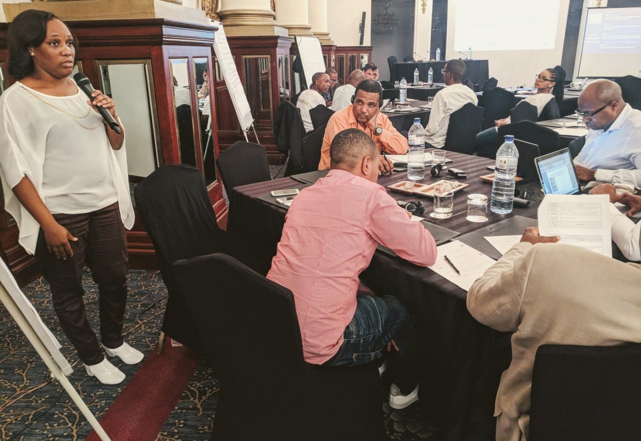 Key stakeholders debate the gaps in Mozambique’s disaster response system which need to be filled for effective deployment and coordination of UAVs in humanitarian operations.
Mozambique is at the very beginning in terms of developing formal airspace regulations for UAVs. The civil aviation administration of Mozambique (ICAM) joins for a deep dive into permissions procedures, exemptions and notifications, training and licensing. Although the rule structure is still in its infancy here, with serious concerns over capacity limitations on the institutional side, creative ideas pop up quickly. One of them is the creation of a flexible licensing and registration program to be jointly administered as a public-private-nonprofit partnership with the country’s active UAV hobbyist association. That system in turn might lead to better understanding of the distribution of human and technological resources around the country.
The national disaster management agency, INGC, has already begun in limited ways using UAVs for disaster response with impressive preliminary result. With only two DJI Phantom 4s in their fleet they have nonetheless managed to advance projects in both 2D and 3D mapping of urban and rural risk area. In addition to this incipient governmental capacity Mozambique hosts innovative non-profit organizations like ThirdEye which impressively utilizes drones for improving small-holder agricultural productivity and water conservation, and wants to play a stronger role in future disaster response actions. ThirdEye’s fleet consists of multiple Phantoms, which under the right conditions could augment public capacity in important new ways. In Mozambique, expanding public-private partnerships point part of the way forward.
Data was also one of the crucial topics of the gap analysis. Mozambique is hardly unique in being under-resourced when it comes to use of geographic information systems (GIS) and other forms of data science to make sense of the products of UAV flights. UAVs create enormous volumes of image data which require interpretation and communication with decision makers. To solve this issue and make sure UAV applications don’t clog up informational pipelines during disasters, participants identified a combination of improved training and human resources, expanded analytic software, database and systems access, enhanced network capability to distribute data and information products, as well as development of standard analytic workflows to be practiced routinely as part of disaster resilience efforts. International partnerships with groups like WFP, ETC, WeRobotics and others can and should prioritize this kind of data capacity as a core element of all humanitarian UAV programs.
In the Field: Elements of Effective Humanitarian UAV Coordination
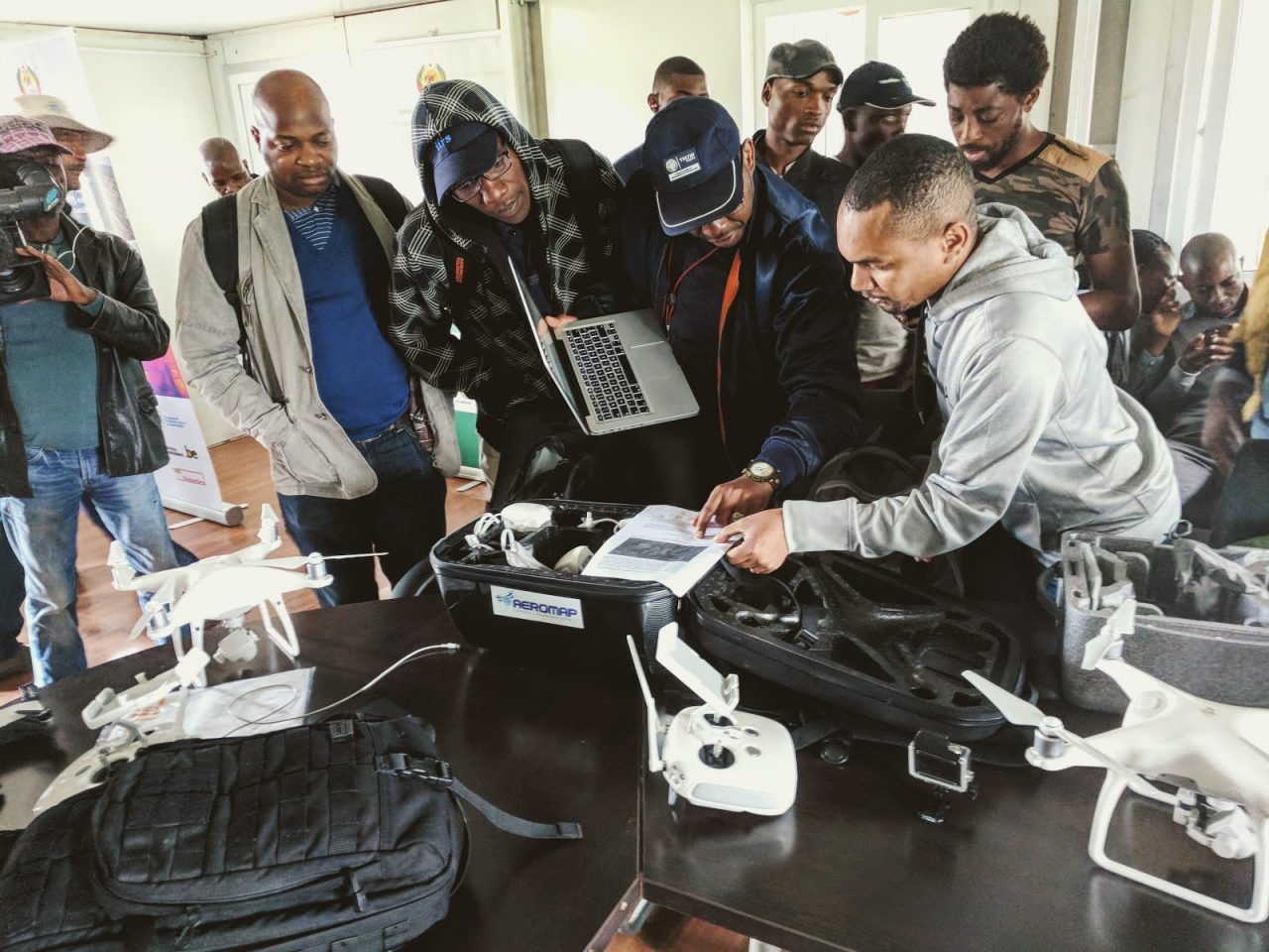 Mozambique disaster responders including INGC and others focus on adapting flight plans to changing conditions.
During the field simulation, issues identified in the gap analysis came to life. The morning was not only overcast but windy, especially at higher altitudes. GPS signals flickered to life and faded. Video streams from the vehicles lit up and then dissolved into static. Troubleshooting flight plans became an effort of paramount importance, emphasizing the need for robust scenario outlines prior to arrival on the scene. Quickly the amount of work which would need to be front-loaded in planning simply to account for variance in ground conditions became apparent. Communications workflows need to be similarly robust in order to enable flexibility and mobility in the face of uncertain and shifting conditions.
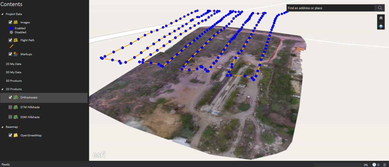 Esri’s Drone2Map photogrammetry and GIS software enables rapid processing and analysis in the field.
Other key lessons learned from the simulation included the following:
By day’s end the mood was light, collaborative and forward-leaning, towards a possible future where UAVs are routinely and effectively integrated into humanitarian airspace, data flows and decision-making processes, enabling responders to more effectively meet the needs of disaster-affected populations.
Join the conversation!
![]()
![]()
![]()
