
Breaking the Language Barrier: WeRobotics Partners with Beluga Linguistics...
April 23, 2024
With language localization, the Flying Labs Network will now step into a more interconnected and inclusive future.
February 2nd, 2017

Nepal Flying Labs (NFL) has been busy these last few weeks, with Local coordinator Uttam Pudasaini organizing three different drone-based social good projects in January. WeRobotics cofounder Adam Klaptocz traveled to Nepal to provide support for this busy week of work, resulting in some incredible datasets.
NFL recently partnered with the Himalayan College of Agricultural Sciences & Technology (HICAST), and a trial drone flight was conducted for agricultural study. The purpose of this mission was to demonstrate that some aspects of precision agriculture can be applied to low-income farmers, without the need of expensive variable-rate application technology. More specifically, the team tested whether the causes of low crop yield can be identified, and subsequently mitigated or corrected using low-cost drone imagery, on-ground scouting, and soil sampling. The team mapped a local kiwi farm in a terraced field of Sindupalchwok, using a Parrot Sequoia camera to measure both RGB (to measure the terrace and drainage structure) and multispectral data (to gain insight into crop health).
The rest of the week was spend in Ramechap, a rural mountainous area east of Kathmandu, just south of the Himalayas. A first project was a classic cadastral survey in the rural outskirts of Manthali, but with a twist: time-tested hand-drawn cadastre were being compared to a high-tech drone-based mapping using a DJI Inspire. The project was led by the district office of the Survey Department of Nepal, though the entire community took part in preparing the ground control points.
Lastly, in partnership with the Swiss NGO Medair, NFL carried out a survey of a massive landslide in the hills of Ramechap district that’s claimed dozens of local farms and is at risk of engulfing local villages. The range of elevations involved in mapping this landslide made it an extremely difficulty challenge, with over 800m in elevation change between top and bottom of the landslide. The 3D flight-planning features of senseFly’s drones, as well as extensive experience in drone-mapping of mountainous terrain, were key to the success of this project. We hope that, through projects such as this incredible landslide mapping, NFL can become a leading center of expertise in the unique skills required to map highly-mountainous terrain with drones.
Data processing and analysis is still undergoing for these three missions. As that is completed NFL will publish the results in blogs posts to the NFL website, along with more detailed writeups of the specific missions. For now you can look at a few of the photos from this busy week below.
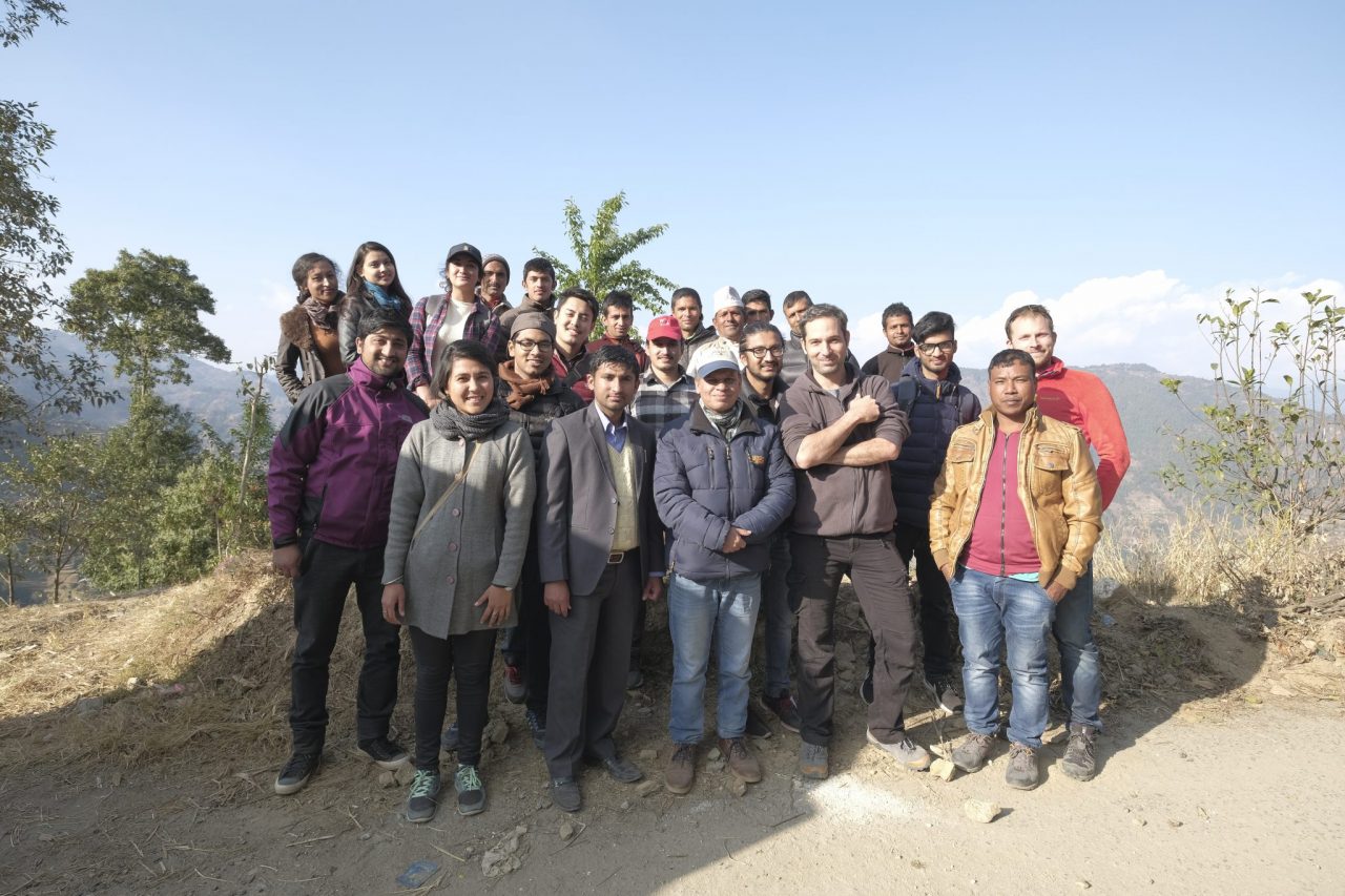 The WeRobotics/NFL team along with students and professors from HICAST.
 Uttam preparing the eBee for the agricultural mapping at the kiwi farm in Sindupalchwok.
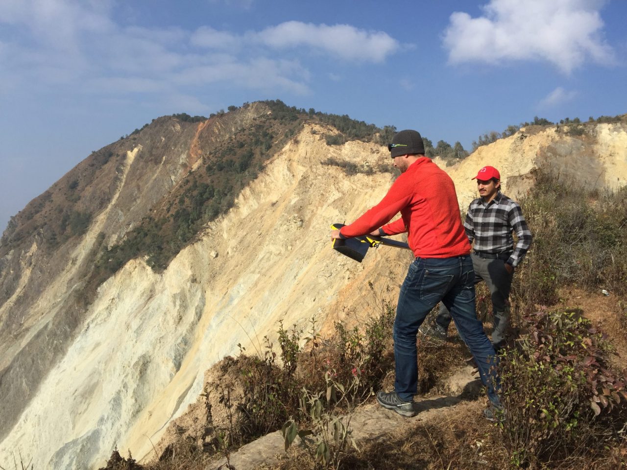 Adam launching the eBee Plus for the landslide survey in Ramechap.
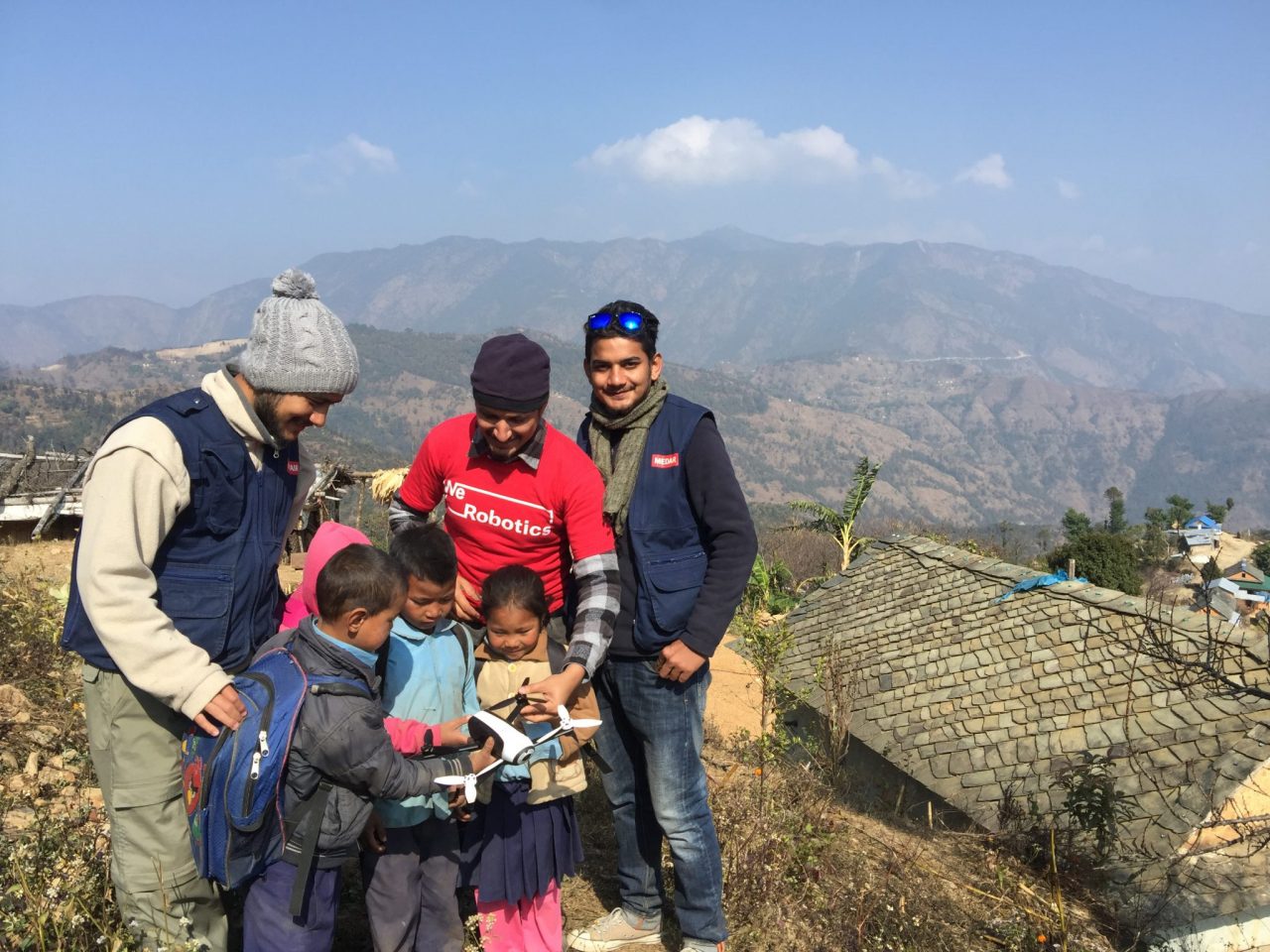 Local children are interested in the team’s Parrot Bebop drone.
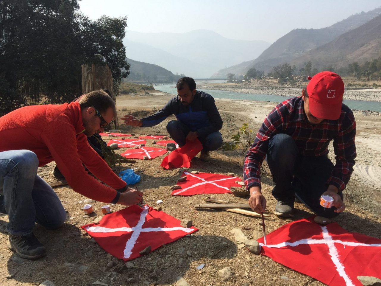 The entire community took part in preparing the ground control points.
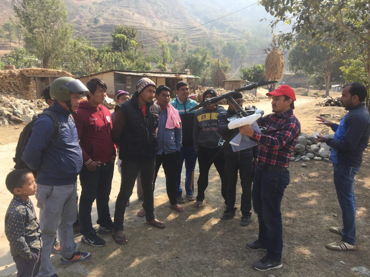 Uttam showing townspeople the DJI Inspire that will be used for the cadastral survey.
Join the conversation!
![]()
![]()
![]()
