
Reframing Power: Perspectives from the Flying Labs Network
April 8, 2024
Flying Labs share their perspectives on power in a profound demonstration of what we mean when we say the “Power of Local”.
October 4th, 2016

We recently organized a professional Flying Labs training session in Nepal. These hands-on trainings are key to our local capacity building efforts as they provide our Labs and partners with the skills and appropriate robotics solution that they need to scale the positive impact of their humanitarian, development and environmental efforts. The training, which took place in early September, focused on the "Use of UAVs for Agriculture and Building Damage Assessment" and was specifically geared towards Geomatics students at Kathmandu University (KU).
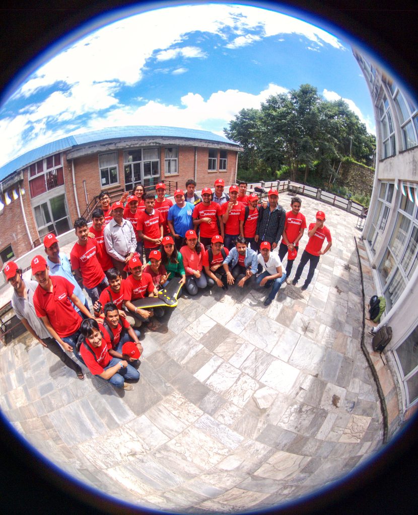 Graduating class of UAV training at KU
Training at Kathmandu University
The first part of the training included presentations from KU faculty on recent drone-based activities at the University and the latest updates on local drone laws from the director of the Deputy Director of the Civil Aviation Authority of Nepal (CAAN).
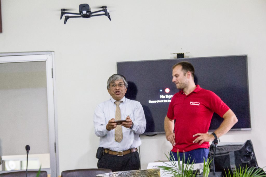 Prof. Maskey trying his hand at controlling a Bebop2 for the first time
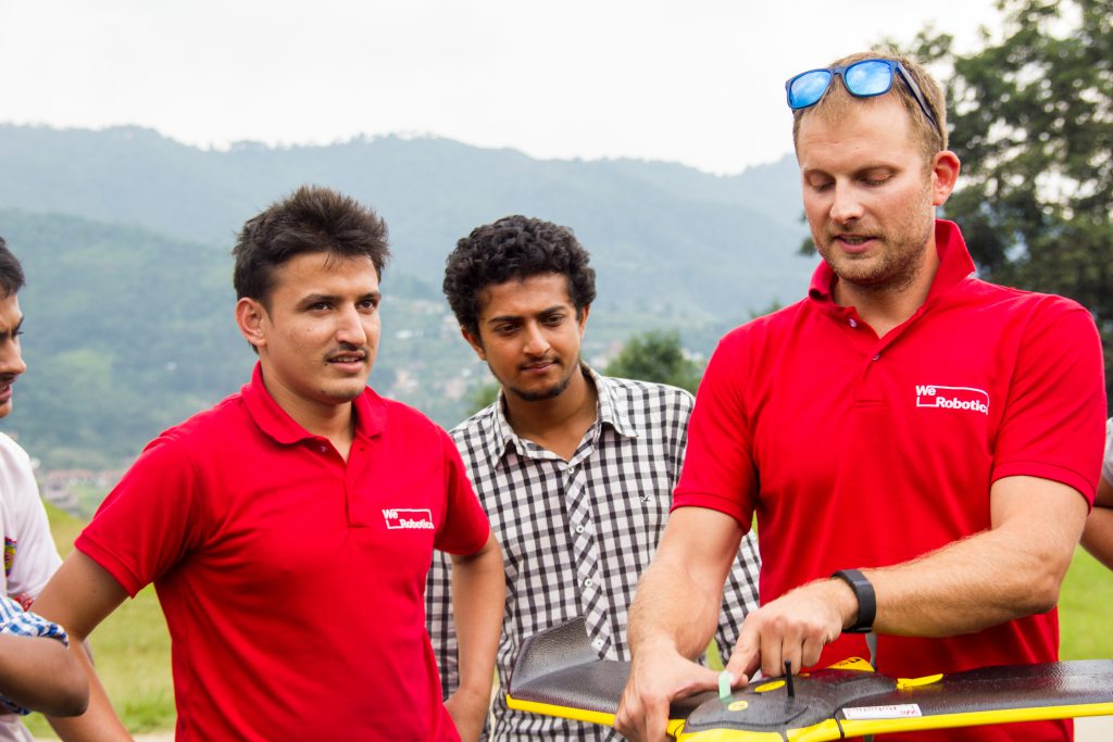
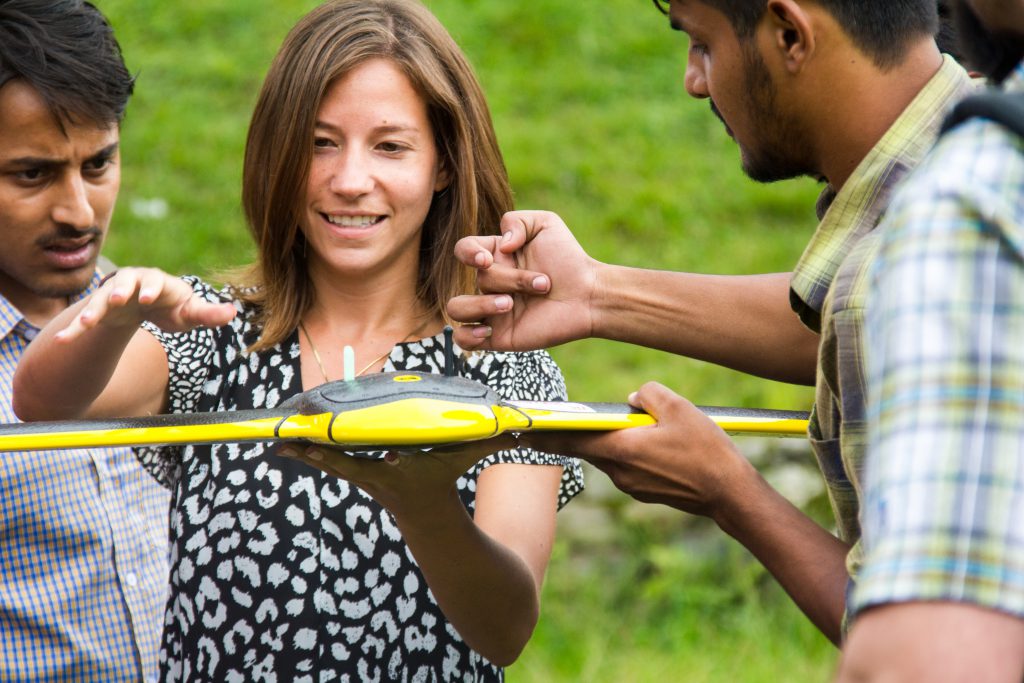
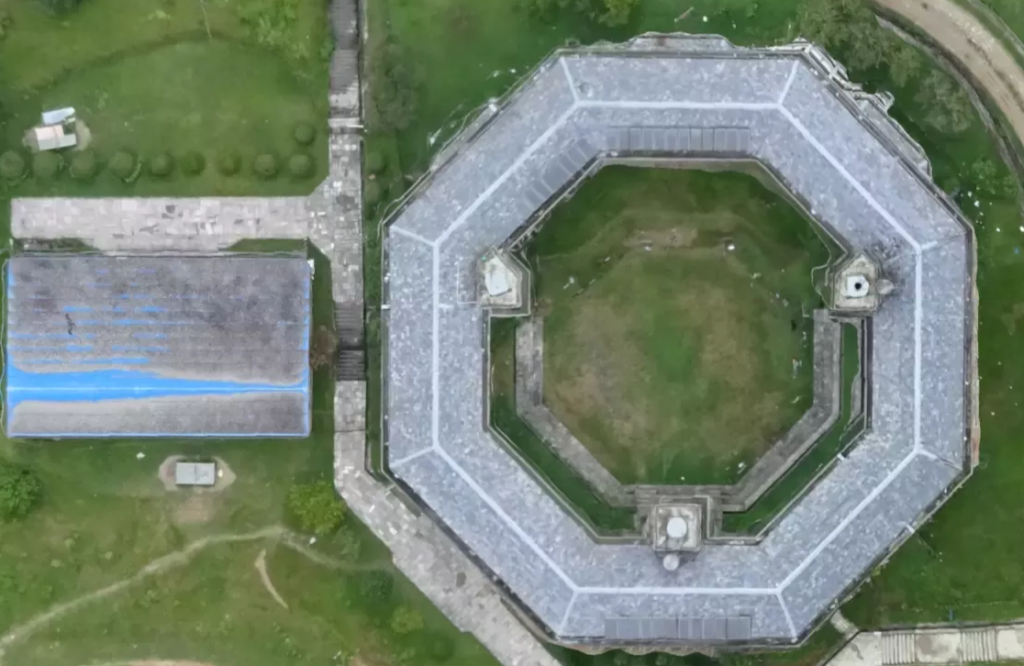
Theory is of course important but the fun part of a training is always the launch! For this training, we focused on senseFly's eBee, a fixed-wing drone with a 45 minute flight time, and advanced 3D planning features which make it ideal for Nepal's mountainous terrain. More information on our growing network of Technology Partners here. The entire trainee team went down to the football field to practice our drone launching skills. We did a sample mapping project, flying the eBee over the grounds of Kathmandu University to create a 5cm-resolution orthomosaic using Pix4Dmapper of the university grounds.
Click below to explore the map:
And check out the 3D model of the KU campus:
Agricultural Field Work
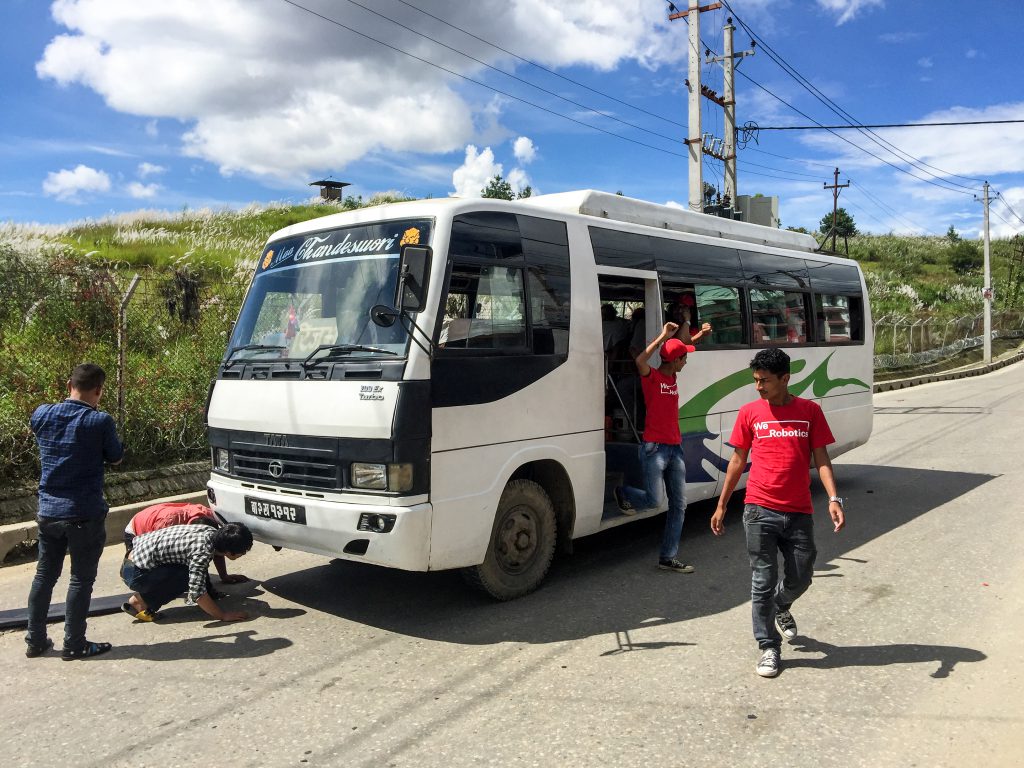
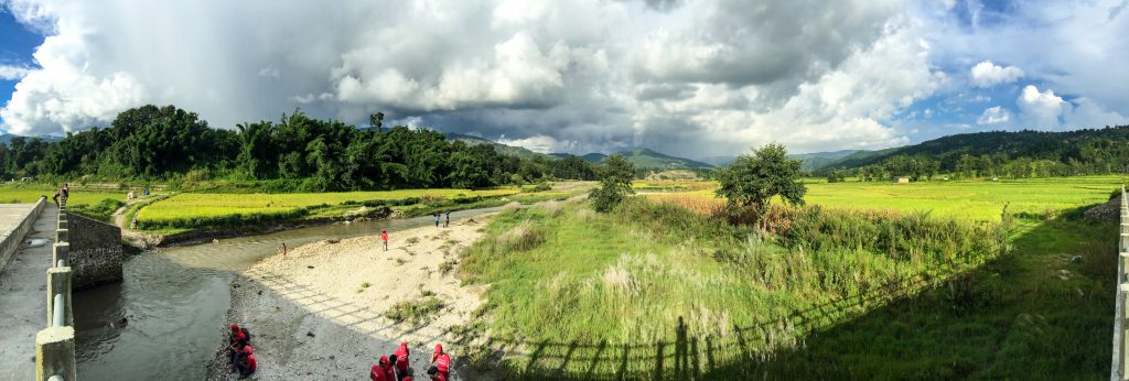
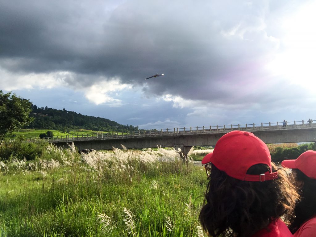
Once the hands-on training was completed it was time to put the trainees' new eBee skills to the test. We headed out to rice fields outside of Kathmandu, where students had already been flying DJI Phantom drones to create RGB basemaps. (We provided KU with training on these Phantoms last year in partnership with DJI and Pix4D; more on this here). The trip to the rice fields was not without adventure; on our way to the field the bus broke down. Luckily, it broke right beside a motorcycle repair shop, and with some basic tools, some tape and a lot of hope, we managed to get back on the road.
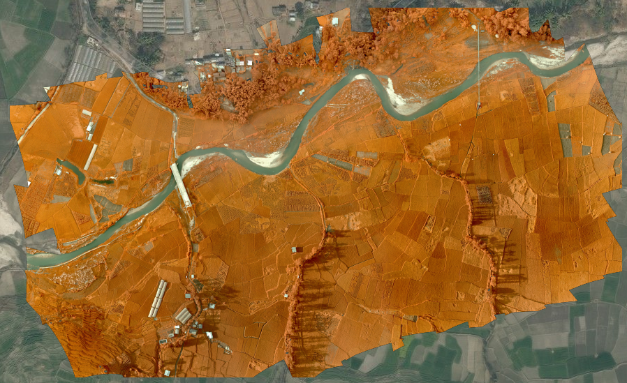
Once on-site, we used a Red-Edge camera to capture data on fields, complementing previously-captured RGB data.
Here's the result of the aerial survey with the Red-Edge camera:
And here's preliminary plant health analysis of the rice fields (you can zoom in out and around in this imagery embed):
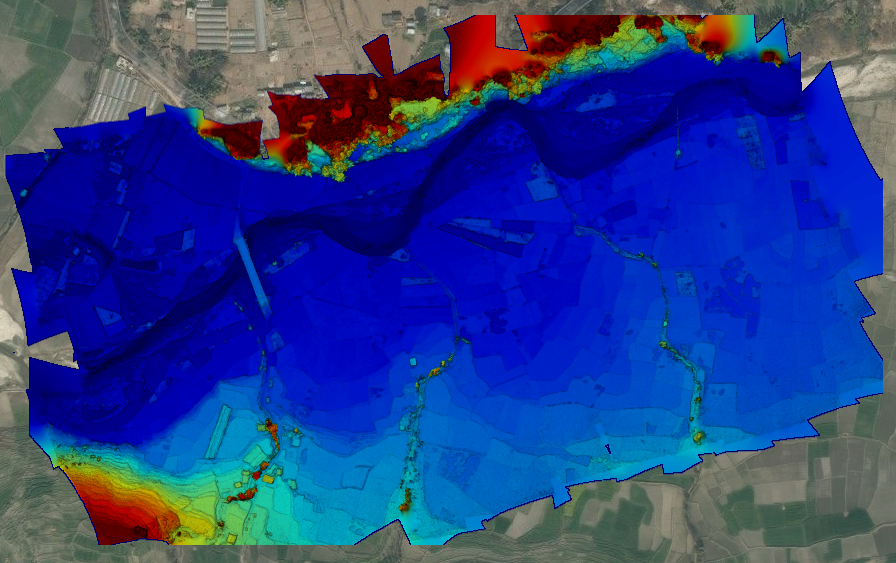
And here's an elevation model that can help identify which areas along the river may be most prone to flooding (blues refer to lowest elevation, reds to high) and thus calculate flood risk:
Flying drones in Nepal, at least legally, remains a challenge. Getting permission to fly over the agricultural field required several weeks of phone calls, official letters and forms. Once we were in the field, a last-minute courtesy call to the local Air Traffic Control authority revealed that we still needed an official letter from the company doing sky-diving many kilometers away, just to make sure we're not getting in their way.
Next Steps on Flying Labs
These and other challenges are in part why we are creating Kathmandu Flying Labs (KFL) as an expert centre within Nepal. Led by our Lab Coordinator, Uttam Pudasaini, KFL will be running drone-based mapping projects with National and International NGOs, government agencies, will be hosting training sessions in the use of drones for GIS, and will help incubate local service companies once a mature market is established. Our aim is to both build local capacity in Nepal and to continue gaining the trust and respect of the country's aviation authority.
KFL is now entering Phase 3 of our Flying Labs Framework. This phase comprises a series of drone projects spearheaded directly by Uttam, the Coordinator of Kathmandu Flying Labs with remote support from the team at WeRobotics. Uttam has been fully trained on the use of the eBee as well as the Bebop2. And he has already already received several really interesting requests for aerial surveys from a range of different partners in Nepal. We're excited to support him as he continues to build his Flying Labs team in Kathmandu to move forward on these projects.
The fourth and final phase of our framework is focused on incubating a local business that provides drones as service. This is to ensure sustainability and continuity while creating new jobs in the robotics sector. We had a number of meetings with partners in Kathmandu and at KU to discuss this next phase, which is scheduled for early 2017. We look forward to returning to Nepal to provide professional training specifically on how to create a successful business focused on drones as a service. As part of Phase 4, we'll also be holding a local business plan competition and providing the winning team seed funding to launch their business.
As part of the WeRobotics Global Network, KFL will also be sharing it's experience across phases with other Flying Labs from around the world.
For a full gallery of the training have a look below:
